In this blogpost a workflow is described on how to use Navisworks quantification in combination with Civil 3D Surfaces.
Why? In Building projects, Navisworks is already heavily used as a quantity surveying tool for the building itself. A building project also typically involves landscaping and earthworks which is best done in AutoCAD Civil 3D.
Although Volume calculation is a core functionality of Civil 3D, sometimes it is required to have one single quantification tool for the whole project.
This is example of a very basic situation, with the primary goal to describe the workflow. In more complex situations, the workflow is the same.
Step1: Create an Existing Ground surface and a Surface for e.g. a building pad, earthwork model of a road, pipe trench etc…
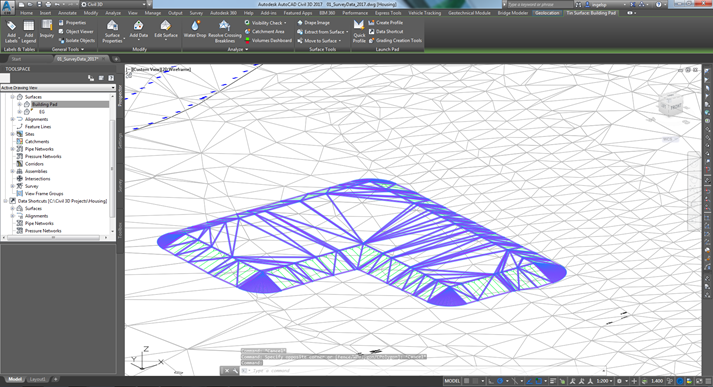
Step2: Create a solid model between 2 surfaces
When selecting one of the 2 surfaces, in the contextual ribbon, in the surface tools pane, select 'Extract Solids from Surface'
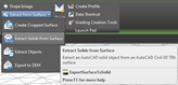
In the dialog that comes up select the surface you…
Leave a Comment
You must be logged in to post a comment.